As the Mountain Parkway continues expanding across eastern Kentucky, some residents of Magoffin County might be wondering what is happening, what will happen in the months and years to come, and especially, who might lose some or all of their land. I was able to attend the community meeting at Magoffin County High School on February 21st. I asked some questions about my own property and took some notes on the proposed routes. Mr. Allen of Magoffin News Network was able to conduct a brief phone interview with Matthew Wireman, Judge Executive of Magoffin County, on February 27th. The following is a brief overview of what we currently know about the eastward expansion of the Mountain Parkway.
Share This!
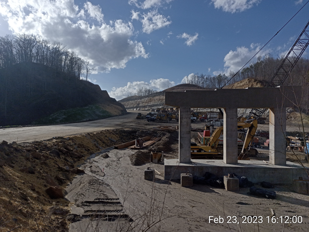
Magoffin County’s Cow Creek and Johnson Fork to Receive Overpasses and Parkway Updates
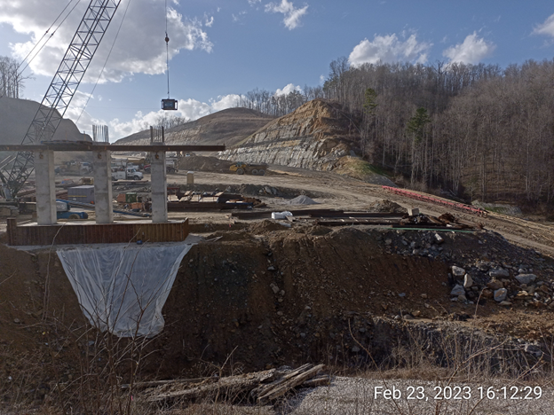
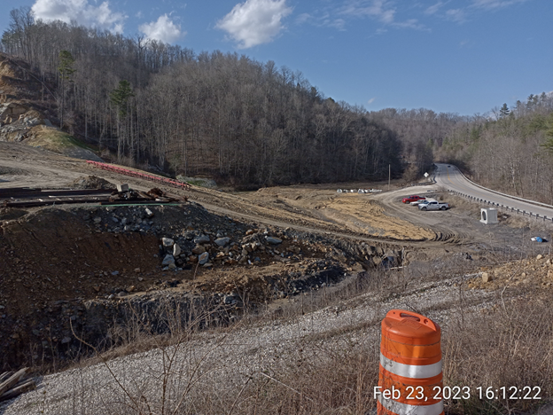
The area in Magoffin County which appears most affected are the areas of Cow Creek and the Left Hand Fork of Johnson Fork. Construction is underway at those places to build overpasses, straighten the parkway, and connect the already-completed Gifford section to other completed sections, further west. Of particular note is the Cow Creek area. Right now, in the area of Cow Creek, there is a sharp curve that brings the parkway close to Johnson Fork, with a short approximately 20-foot connection, allowing people to directly move between Johnson Fork and the parkway. The new route, however, will bypass this curve entirely.
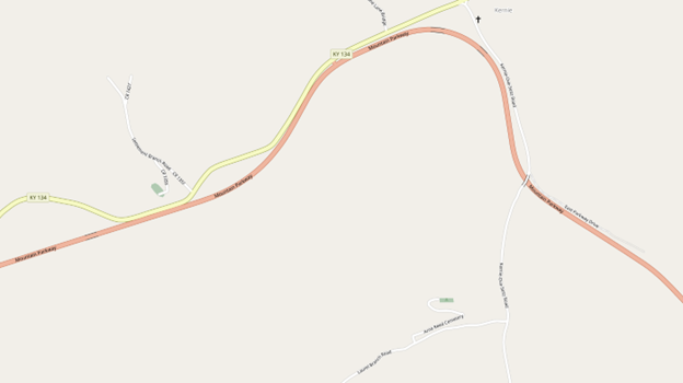
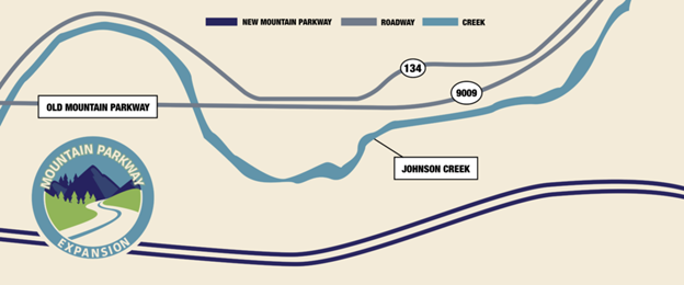
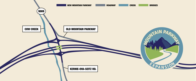
It appears as though the parkway will rejoin itself at the existing Cow Creek overpass. I was informed by construction crews on site, when finished, if you want to move between the parkway and Johnson Fork, you will have to do so by way of Cow Creek and a new exit ramp.
Upcoming Changes to Dry Bread: Proposed Route and Impacts to Local Community
The next area that will see an immediate impact is Dry Bread, continuing on to the Floyd County line. This area has not seen any construction, and “officially,” according to the representatives I spoke to at the community meeting on February 21st, neither a contractor nor the finalized route has been determined for that portion. When observing the map, both potential routes are still outlined. However, “unofficially,” everyone I’ve spoken to indicates that the “cross country” route is the preferred and most likely outcome. When these routes were first outlined, I examined the proposed cross-country route and overlaid it with satellite imagery. I found that it appeared to be going directly over top of the residence of Mr. Kenneth Penix, of Dry Bread. At the meeting, however, the map shows that the cross-country route has moved South at the Dry Bread crossing, now going over the top of the unoccupied Myrtle Patrick homeplace. A few months ago I saw some surveyors roaming around that property taking measurements, so this adjusted map confirms my suspicions.
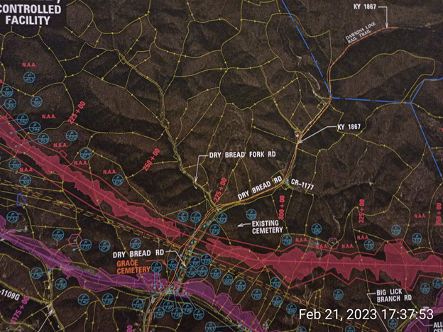
One of the concerns that I brought up at the community meeting was that of well water. I live on Dry Bread Fork Road, the left fork of Dry Bread. There is no municipal water service here; everybody here uses well water, and regardless of which route they take, they’ll be setting off dynamite dangerously close to our land. When I brought this up, I was directed by the representatives to complete and mail in a “comment form” detailing my concerns. I handed one of those forms out to everybody in my area of Dry Bread and posted a copy of it to my personal Facebook page. I was told that when a contracting company is chosen, that company will be responsible for conducting a “pre-blast survey” of the area and taking appropriate precautions to minimize the danger to things like well water. If you live in this area, I recommend keeping an eye out for representatives conducting such surveys. The impression I got was that the responsibility for preventing or compensating residents for damages would fall on that company, not the State, or the Department of Transportation.
Local Residents Voice Concerns Over Potential Impacts of Parkway Expansion in Magoffin County
Many residents, however, are less than thrilled about the potential impacts of the expansion. While the expansion promises to optimize and shorten travel times for people along the parkway, making it a more attractive thoroughfare for commercial traffic and therefore more attractive to businesses looking for a place to expand into, like the Magoffin County industrial park; it also seeks to uproot and even landlock a lot of people, no matter which route it takes.
Some of those people have spent their whole lives or even several generations on their land. They see the expansion as a means to help Pikeville and Lexington, at the expense of locals in places like Magoffin County.
One landowner affected by the expansion is Mr. Joe Frazier, of Magoffin County. When asked for his thoughts on landowners losing property, a disheartened Mr. Frazier said, “It takes everything that we own.”
He continued, “It goes behind my house and through my house, we’ve lived here 53 years.” Mr. Fraizer later clarified that it even takes his mother’s home. He reiterated, “It takes everything we’ve got. The hundreds of thousands of cubic yards of dirt they’re gonna have to move to go that way, ya know, it does not justify going that way. I can’t see it.” Landowners and others in the area we have spoken to express reservations about the likelihood of any tangible benefits to Magoffin County directly, and see the expansion as a way to make bypassing Magoffin easier for people traveling between Lexington and Pikeville.
Mountain Parkway Expansion: Conclusion
Will the expansion bring long-term benefits to Magoffin County? Will the new industrial park be an attractive place for companies to set up shop once the expansion is completed? Will it bring economic uplift to an area with one of the highest poverty rates in the state? Or, are we just an obstacle that must be overcome to help bigger economic players?
Only time will tell. Whether we like it or not, the expansion is ongoing. Funding is en-route and it’s expected to take another 6-8 years to complete the Magoffin County portion of the expansion. When speaking about the community meeting on February 21st, County Judge Executive Matthew Wireman stated, “They basically said they had funding for most of the Magoffin County section already earmarked, but then the Floyd County section on will have to come out of a different session.”
If you have concerns or questions about the impact of the construction or want to look at the map of areas we didn’t discuss here, here are a few ways you can contact the Mountain Parkway Expansion Office. You have a right to more information, or to make them aware of any concerns you have.
- Website: https://mtnparkway.com
- EMail: info@mtnparkway.com
- Phone: (606) 349-8160
If you would like to have your business or community event promoted, be sure to check out our about page and learn how to contact us directly!