
🌧️ REMNANTS OF HURRICANE ISAIAS COULD BRING RAIN, GUSTY WINDS TO EASTERN KENTUCKY
Appalachia Insider · October 8, 2026
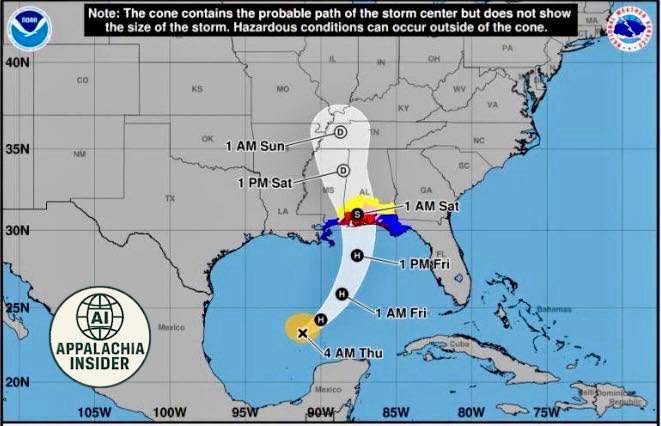
The National Weather Service in Jackson says the remnants of Hurricane Isaias are expected to impact Eastern Kentucky late Saturday into Sunday, bringing rain and breezy conditions.
Forecasters say the strongest wind gusts could reach or exceed 40 mph along higher-elevation ridges, while isolated flash flooding will also be possible.
The exact track remains uncertain, which will determine how much rain and wind the region ultimately receives. Residents are encouraged to monitor updates as the forecast develops.
Source: US National Weather Service Jackson Kentucky
#AppalachiaInsider #EasternKentucky #HurricaneIsaias #WeatherAlert #Rain #Flooding